With more than two decades of experience in the mapping industry, we are well aligned with evolving technologies and changing customer needs. By continuously adopting new software and production methodologies, we enhance our capabilities and improve delivery efficiency.
We have established dedicated teams for each deliverable as part of our production process. Our strong team of professionals efficiently executes projects with precision and reliability. Over the years, we have developed specialized methodologies for different mapping domains to enhance production efficiency and deliver the best results.
Having been in this business for more than 2 decades we are comfortably tuned into adapting to changing technologies and customer needs as demanded by the ever-increasing customized applications.
We work on photogrammetric Aerial images, Satellite images, Drone images and point cloud inputs of various scales to provide high-accuracy spatial data. Our services in photogrammetry include
LiDAR is currently the most comprehensive and accurate method of creating spatial data. Lotus Geosolutions has an exceptional team to provide consistency in quality and cost-effective LiDAR services.
Ground classification (Bare earth extraction) and advanced ground classification are performed. Our LiDAR services include
Lotus Geosolutions provides comprehensive GIS data by processing Georeference, Projection conversion and Data attribution. The GDB of the project is validated by our QA team and delivered on-time with persistent quality. Our GIS services include
An orthoimage is an aerial or satellite image that has been geometrically corrected (orthorectified) to ensure uniform scale and mapping accuracy. At Lotus Geo Solutions, we offer advanced orthoimage processing services to support precise and reliable geospatial analysis. Our Orthophoto production services include
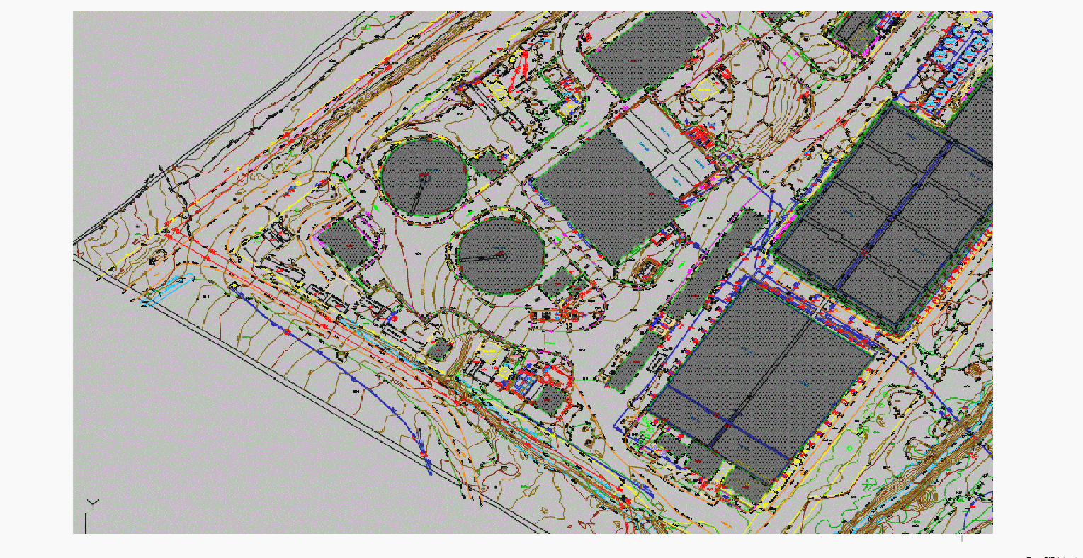
BIM revolutionizes the design, construction, and operation of buildings by creating a digital twin of real-world projects. At Lotus Geo Solutions, we offer comprehensive BIM services that are transforming the construction industry. We work closely with clients to develop custom 3D Revit models, with a strong emphasis on accuracy in every model we create. We provide Scan to BIM for
Our organization works with clients in line with their needs to create custom 3D Revit models. We have a skilled workforce of BIM modellers enough to deliver tailor-made 3D modelling services just the way the clients want. We mostly emphasize precision when it comes to Revit 3D modelling.